
News
STAFF FROM EHRENSVÄRDSKA HIGH SCHOOL AT BTH AND THE HINTS LABORATORY
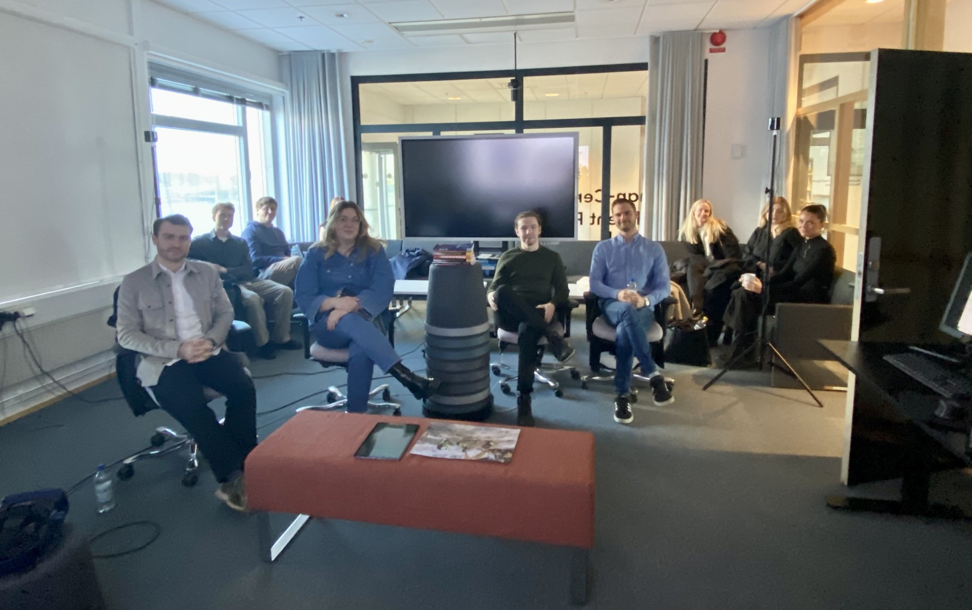
Today we had a visit of staff from Ehrensvärdska High School in the Human-Centered Intelligent Realities Laboratory. The visitors got to hear about the HINTS project and ongoing research. The participants also tested some augmented reality (AR) and eye-tracking demos. Thanks to Johan Hjortsberg at BTH for the organisation of the event!
SMART START GRADUATE TRAINEES AT BTH AND THE HINTS LABORATORY
Today we had a visit of smart start graduate trainees @ BTH in the Human-Centered Intelligent Realities Laboratory. The visitors from SAAB, Roxtec, NIBE, Region Kalmar, Xylem, Ankarsrum and Sydsvenska Handelskammaren got to hear about the HINTS project and ongoing research. The participants also tested some augmented reality (AR) and eye-tracking demos. Thanks to Andreas Larsson at BTH for the organisation of the event!
PAPER ACCEPTED TO EUROGRAPHICS EDUCATION PAPERS 2024
The following paper has been accepted to the Eurographics Education Paper 2024 track:
Y. Hu, V. Sundstedt, P. Goswami, A Research Methodology Course in a Game Development Curriculum, Eurographics Education Papers, 2024, accepted.
It describes a course curriculum using research labs in education at BTH, including the new Human-Centered Intelligent Realities Laboratory.
Visit and Guest Lecture by Dr Eng. Izabela Karsznia: May AI help you? Improving Settlement and Road Network Design for Maps of Small Scales Using Artificial Intelligence
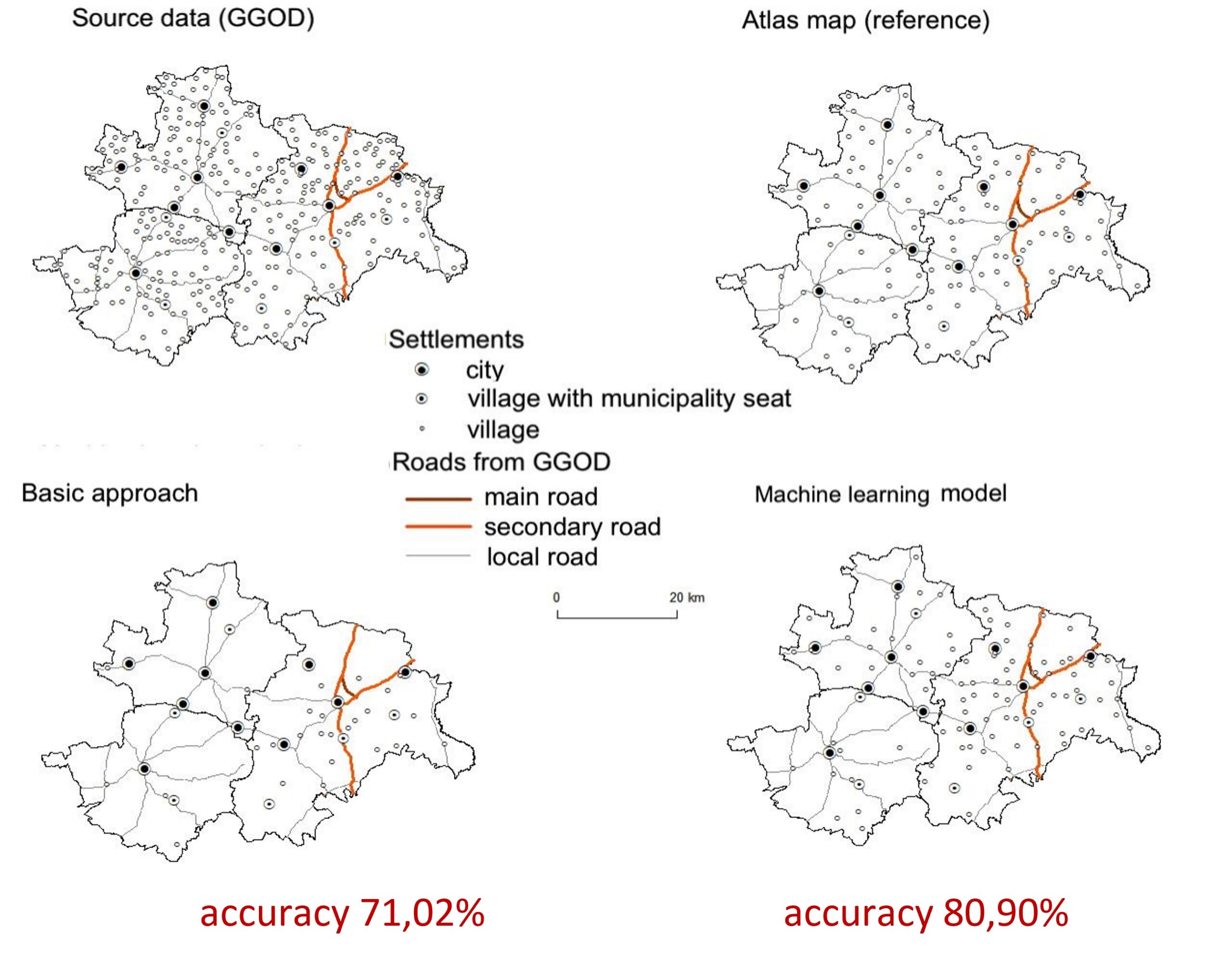
Guest Lecture “May AI help you? Improving Settlement and Road Network Design for Maps of Small Scales Using Artificial Intelligence” by Dr Eng. Izabela Karsznia, April 10, 12:10-12:50, Room J1630
Cartographic generalization is an essential element of map design. It is defined as the deliberate and logical process of reducing the detail of map content while taking into account the purpose of the map, the level of detail (map scale), the perceptual capabilities and limitations of the user as well as the application environment. In this research, we specifically tackle selection of objects, which is the first and crucial task to undertake in cartographic generalization. Selection affects the quantity of visual information since it removes part of the map or database content. The goal of selection is to maintain essential objects and omit irrelevant ones. Thus, selection deals with deciding which objects we will show on the map at a smaller scale. This decision is not straightforward, especially at geographical scales. Although we always select the most relevant and important objects, importance or relevance can be measured differently. To make this demanding decisive process automatic and more efficient we use AI based, especially Machine Learning algorithms. We use AI and ML algorithms to improve settlement and road network selection at geographical, atlas scales. We also use them to explore and make explicit the implicit cartographic knowledge that went into manually designed maps.
This talk will focus on developing automatic selection models that would support the small-scale map design process, making it faster, cost-effective and more objective. The development of a generalization process supported by artificial intelligence leads to an algorithm that approximates the decision-making process previously undertaken by an experienced cartographer. We concentrate on settlements and road network selection contained in General Geographic Objects Database from 1:250 000 scale to smaller scales. We use AI and ML solutions based on both white box as decision trees and black box like deep learning approaches.
Biographical data of the speaker:
Izabela Karsznia – received PhD at the Faculty of Geography and Regional Studies, University of Warsaw in 2010. Since 2010 she has been working as an Assistant Professor at the Department of Geoinformatics, Cartography and Remote Sensing, Faculty of Geography and Regional Studies, University of Warsaw. She actively cooperates with national and international mapping agencies on projects concerning cartographic generalization and spatial data infrastructure development. Between 2014 and 2015 she was working as a Postdoctoral Fellow at the GIS Unit, Department of Geography, University of Zurich. Her research interests concern Geographic Information Systems, historical GIS, automation of cartographic generalization with the use of artificial intelligence, spatial data infrastructure development.
More details can be found at http://geoinformatics.uw.edu.pl/izabela-karsznia/ and http://geoinformatics.uw.edu.pl/generalizationai/
Press Contacts
Veronica Sundstedt, Project Leader
Valeria Garro, Website Content
Anna Zieris, HINTS Administrator
For additional project information, please contact: hints@bth.se